
Google is introducing Gemini to Maps in India, along with new road safety notifications and enhanced route details.
This AI feature, which debuted in the U.S. on Wednesday, enables hands-free AI support in Maps, offers relevant suggestions during navigation, and provides details about nearby attractions.
Miriam Daniel, who serves as vice president and head of Google Maps, explained that the launch involved extensive adaptation for the local market.
“When we talk about localizing for India, it goes beyond just language,” she explained during a virtual press event. “It’s also about tailoring the experience to how people in India interact with the app, the way they speak, the questions they ask, how they refer to locations, the unique geopolitical areas, street names—everything is a bit different here.”
According to Google, Gemini in Maps will be accessible to all Android and iOS users in India in the next few weeks, and will initially support nine Indian languages.
Google is also rolling out several India-focused updates for navigation and commuting. Drivers will now receive both visual and audio warnings when approaching accident-prone zones. Google noted that it is collaborating with local authorities on these alerts, which will first be available to Android users in Gurugram, the Cyberabad area of Hyderabad, Chandigarh, and Faridabad.
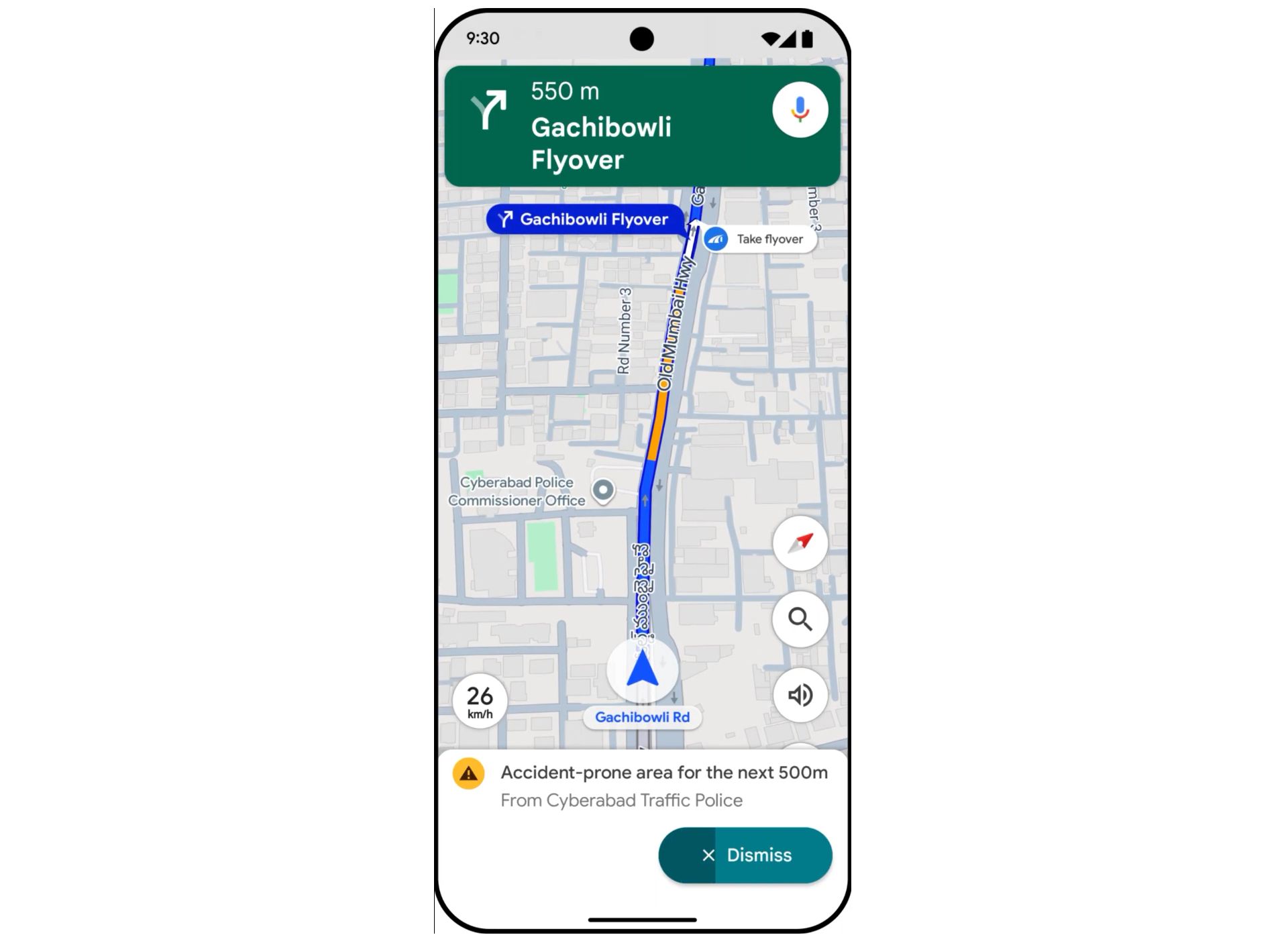 Image Credits:Google
Google has faced criticism in India regarding the accuracy of some navigation routes, particularly after an incident last year in Uttar Pradesh where a car fell from an unfinished bridge, resulting in three fatalities.
“Real-world situations are constantly shifting and can change in a moment, so Maps can’t always be perfectly accurate,” said Anal Ghosh, senior program manager for Google Maps, when asked about alerts for incomplete roads or unfinished bridges. “We advise users to remain attentive and keep their eyes on the road.”
Google stated that it has teamed up with the National Highways Authority of India (NHAI) to receive near real-time updates on road closures, detours, and maintenance work. This partnership will also enable Maps to display roadside facilities such as public toilets, eateries, and fuel stations along national highways.
Additional new features include advance notifications about significant disruptions or delays on routes, even when users are not actively navigating. These alerts are being introduced to Android users for highways and major roads in New Delhi, Mumbai, and Bengaluru.
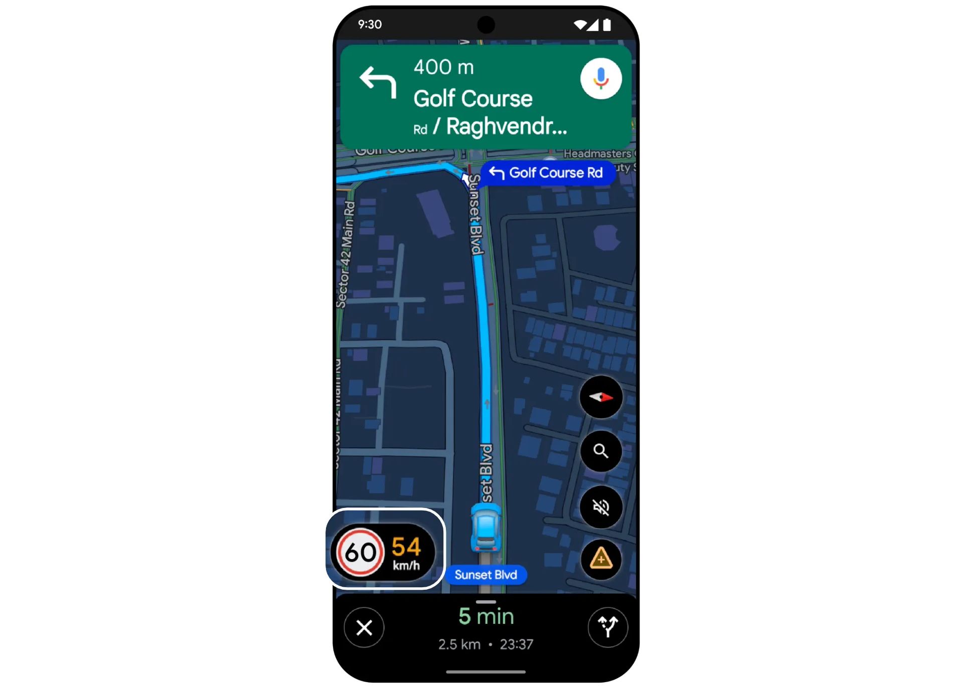 Image Credits:Google
The app will now also show speed limits during navigation, using information from local traffic authorities. This update is being rolled out to Android and iOS users in nine cities: Faridabad, Ghaziabad, Gurugram, Hyderabad (including Cyberabad), Jaipur, Kolkata, Lucknow, Mumbai, and Noida.
Expanding on the flyover navigation feature introduced last year, Maps will soon offer voice guidance for flyovers. This enhancement will be available to Android and iOS users in the coming weeks.